
Methodology 
This is the methodology used to determine the extreme geographic compass points.
For North, it is the point with the largest latitude.
For South, it is the point with the smallest latitude.
For East, it is the point with the largest longitude.
For West, it is the point with the smallest longitude.
For the remaining points, the following method was used to determine the compass points.
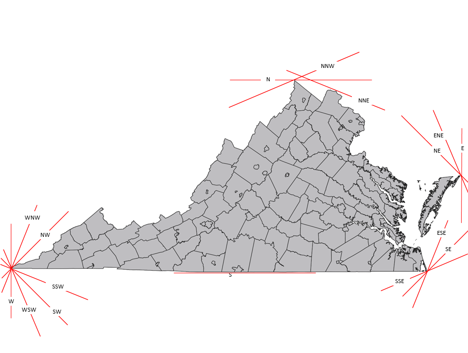
Create a line perpendicular to the angle of direction. Then move the line towards the geographic feature, until it becomes tangent to the feature. The tangent point is the extreme compass direction.
Example
For the Northwest, it is an angle of 315° from North. Use the red line tangent to 315°.
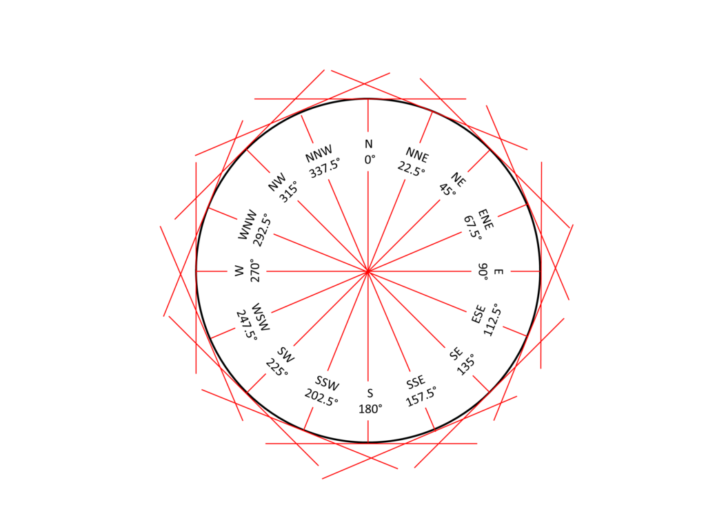
The map below shows the tangent angle for all compass points.

© 2023 by Extreme Geography LLC. All rights reserved. Trademark pending for “Extreme Geography”